 |
|
|
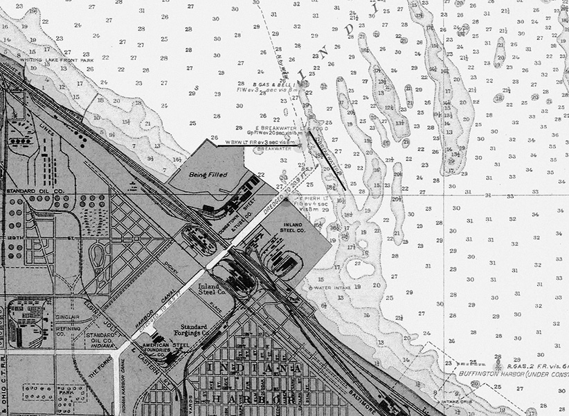
1926 chart of Indiana Harbor.
The canal is complete with arms extending to the Grand Calumet River
and Lake George. Landfill is underway at the canal mouth, both north
and east breakwaters are in place and the new lighthouse is in place at
the outer end of the detached north breakwater. |