|
  Towers
with heights from 30 to 39 feet Towers
with heights from 30 to 39 feet |
|
39’ -
Grand Island6
39’ - Marquette6
39’ - Manistee Pierhead6
39’ - Sturgeon Bay Canal Pierhead6
38’ - McGulpin Point3
38’ - White River6
38’ - Point Peninsula6
38’ - Dunlap Reef rear6
37’ - Sand Point6
37’ - Duluth North Pier6
37’ - Point Betsie6
37’ - Portage Lake Rear6
37’ - Manitowoc Breakwater9
36’ - Fourteen Foot Shoal12
36’ - Saginaw River Front Range6
36’ - Marquette Breakwater6
36’ - Mission Point6
36’ - Grand Haven Pierhead Front6
36’ - Tail Point6
36’ - Racine Pierhead11
35’ - Manistique East Breakwater14
35’ - Duluth Front6
35’ - South Haven Pierhead6
35’ - Waukegan Harbor6
35’ - Two Rivers Pierhead5
35’ - Algoma Pierhead5 |
35’
- Sherwood Point6
35’ - Little Fort11
34’ - Alpena6
34’ - Huron Island6
34’ - Copper Harbor Rear6
34’ - Petoskey Pierhead6
34’ - Port DU Morts11
34’ - Menominee Pierhead6
34’ - Sheboygan11
34’ - Manitowoc11
33’ - Cheboygan Crib6
33’ - Pipe Island6
33’ - Ontonagon Pierhead6
33’ - Two Harbors Breakwater6
33’ - Grassy Island Upper6
31’ - Munising Rear Range6
31’ - Pentwater Pierhead Rear6
31’ - White River Pierhead6
30’ - Round Island11
30’ – Mamajuda1
30’ - Grassy Island1
30’ - Presque Isle Rear6
30’ - Grand Island Harbor2
30’ - St. Joseph Pierhead Front6
30’ - Baileys Harbor Rear6
30’ - Muskegon Main11 |
|
|
 |
Towers
with heights of less than 30 feet |
|
29’ -
Frankfort South Pierhead6
28’ - Au Sable Pierhead6
28’ - Muskegon Pierhead Front6
27’ - Holland Front6
27’ - Plum Island Range Front6
26’ - Grand Haven North Pierhead6
26’ - Grassy Island Lower6
25’ - Portage River Pierhead6
25’ - New Buffalo1
24’ - Grand Island Harbor Front6
24’ - Eagle River2
24’ - Ludington North Breakwater6 |
24’
- Ludington South Breakwater6
22’ - Grand River Main1
22’ - Port Clinton1
22’ - Taylorsport1
21’ - Presque Isle Front6
21’ - Copper Harbor Front6
21’ - Baileys Harbor Front6
19’ - Pentwater Pierhead Front6
18’ - Frying Pan Island6
17’ - Portage Lake Front6
16’ - Dunlap Reef Front6 |
|
|
 |
Sources |
|
|
1
- 1857 Light List
2 - 1871 Great Lakes Light List
3
-
1878 Great Lakes Light List
4 - 1898 Great Lakes Light List
5 - 1909 Station Survey
6 - 1910 Great Lakes Light List
7 - 1917 Great Lakes Light List |
8
- 1931 Great Lakes Light List
9 - 1937 Great Lakes Light List
10 - 1940 Great Lakes Light List
11 - 1868 Light List
12 - 1930 description of
station
13 - 1934 Lake Carriers
Annual Report
14
- Calculated focal plane less crib height
|
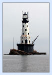
 Lighthouse tower heights in the Western
Great Lakes vary from the diminutive 16-foot Dunlap Front Range light to
the Mighty Rock of Ages Light, with its vent ball soaring 130 feet above
the crib deck.